After hearing Jay Rosner (interview 195 on the “Your College Bound Kid” podcast) say that the UCs use Landscape even though they are test blind - I went down a rabbit hole on SAT landscape and have even tried to see what I could do to reverse engineer the scores for my neighborhood and school. Below are my thoughts on each section. I’d love feedback and suggestions. If anyone has a college freshman who has reviewed their own file and seen the landscape scores for their school and neighborhood, I’d love to know what they learned!
Link to methodology for SAT landscape:
data-methodology-summary.pdf (collegeboard.org)
Part 1: Basic High school Data
Locale (e.g., Rural)
Senior class size
Percent of students eligible for free and reduced-price lunch
Average SAT® scores at colleges attended
AP® participation and performance
This seem like basic info that would be on the school profile except maybe the Average SAT scores at colleges attended. If the majority of students go to the state flagship that may be a good estimate, but if there is a huge distribution of colleges then that will be harder to understand.
Part 2: Test Score Comparison
Applicant’s test score compared to others from the same high school
If you are applying test blind or test optional then no need to “reverse engineer” this scale. However, if you want to know where a score falls you can often find the SAT for scores at every public high school in your state by looking at the state dept of education website. For example, here is Texas: SAT and ACT Data Search and Data Downloads | Texas Education Agency
Part 3: High School and Neighborhood Indicators
College attendance
Household structure
Median family income
Housing stability
Education levels
Crime
Per the college board “Research shows these indicators are related to students’ education outcomes. Two averages are created based on these six indicators. Values are shown on a scale from 1 to 100 relative to the U.S. average.”
*Trying to reverse engineer this is hard. The US census is used for items 2-5, but it isn’t clear how they determine housing stability or household structure. Regardless the data is very user friendly and once you have an address, the data can be presented by census tract and school district so you at least can see what the raw data is that is used by the college board. *
District of Columbia Public Schools, DC - Profile data - Census Reporter
*The link above came from entering “1600 Pennsylvania Ave. Washington DC” into the address search. If you put your own address into the search bar you will get the data from your census tract and your neighborhood schools. *
*I don’t know how to get the college attendance. The methodology says "The predicted probability that a student from the neighborhood/high school enrolls in a four-year college (aggregate College Board and National Student Clearinghouse data) " I don’t think that data is public. *
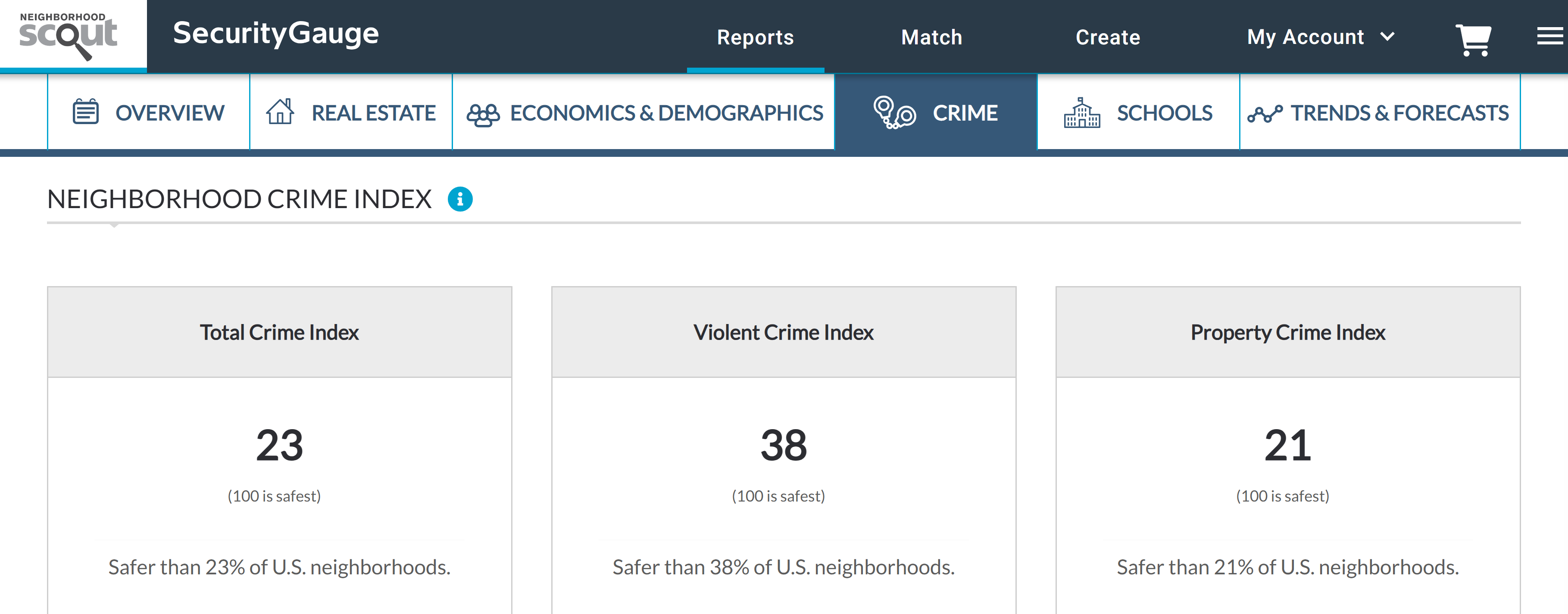
*Crime is " The predicted probability of being a victim of a crime in the neighborhood or neighborhoods represented by the students attending the high school. I did see that Neighborhood scout uses data from the same data broker.
I paid the $30 for my report and got something that looks like this (yikes!).
So, that’s my attempt at reverse engineering the “Landscape” product for the SAT. Feedback? Suggestions? Other data sources? Any interviews anyone has heard about how colleges are using it or which colleges are using it?